📷 Photos
No photographs available yet
Espagnac-Sainte-Eulalie · Lot (46) · France
An extensive cave-diving system with five sumps, constrictions and more than two kilometres of surveyed passages.
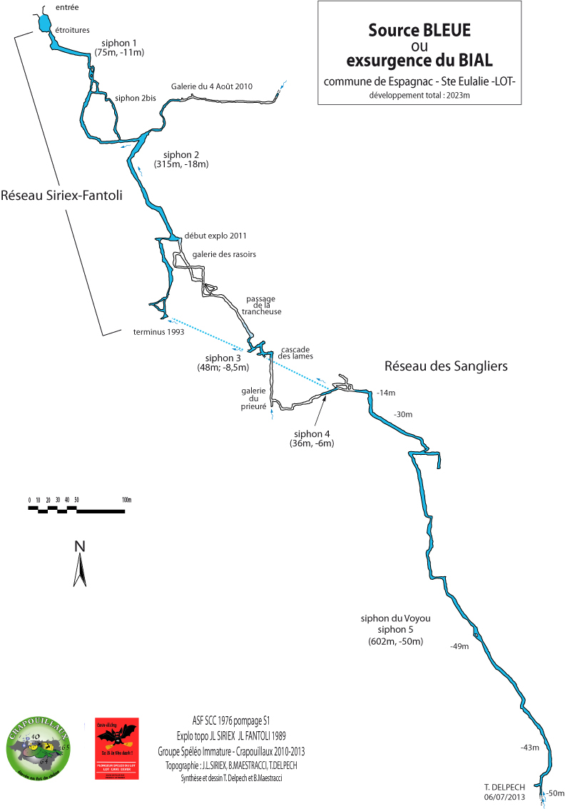
Exsurgence du Bial, also known as Source Bleue or Trou du Diable, is near Espagnac-Sainte-Eulalie in the Célé valley. The 2013 section shows the Siriex-Fantoli and Sangliers networks, with a total surveyed development of about 2,060 m. A separate plan states 2,023 m.
Gravel movement can obstruct the entrance constriction. During high water S1 and S2 may form a single flooded passage. Beyond are dry galleries, narrow fissures and the deep Siphon du Voyou.
The first sump was pumped in 1976. Siriex and Fantoli explored in 1989; Siriex confirmed the S2 bis connection in 1993. Further exploration from 2010 to 2013 extended the mapped system beyond two kilometres.
Click a survey to enlarge it.
Espagnac-Sainte-Eulalie · Célé · Lot (46)
Survey images are reproduced with their original attributions. Confirm usage rights before public publication.